
Lake Hiawatha topographic map
Interactive map
Click on the map to display elevation.
About this map
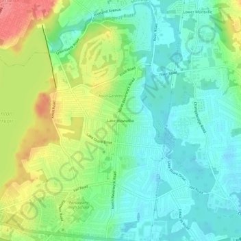
Name: Lake Hiawatha topographic map, elevation, terrain.
Average elevation: 76 m
Minimum elevation: 50 m
Maximum elevation: 129 m
Other topographic maps
Click on a map to view its topography, its elevation and its terrain.
Boonton Reservoir
United States > New Jersey > Morris County > Parsippany-Troy Hills
Average elevation: 102 m