

Vlahata topographic map
Click on the map to display elevation.
Vlahata
Vlachata (Greek: Βλαχάτα, also Βλαχάτα Εικοσιμίας) is a village and a community in the eastern part of the municipal unit of Leivatho near the south coast of the island of Kefalonia, Greece. To avoid confusion with another Vlachata near Sami, it is also known as Vlachata Eikosimias. The community consists of the villages Vlachata and Simotata, which is 2 km east of Vlachata. Vlachata is situated on a mountain slope above the Ionian Sea coast, at about 200 m elevation. Mount Ainos, the highest point of Cephalonia, is 4 km to the northeast. Vlachata is 1 km northwest of Lourdata, 2 km southeast of Mousata, 13 km southwest of Poros and 13 km southeast of Argostoli. The road from Argostoli to Poros runs through Vlachata. Vlachata suffered great damage from the 1953 Ionian earthquake.
About this map

Name: Vlahata topographic map, elevation, terrain.
Average elevation: 263 m
Minimum elevation: 0 m
Maximum elevation: 1,520 m
Other topographic maps
Click on a map to view its topography, its elevation and its terrain.
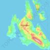
Cephalonia
Greece > Ioanian Islands > Kefallonia Regional Unit
The island's highest mountain is Mount Ainos, with an elevation of 1628 meters; to the west-northwest are the Paliki mountains, where Lixouri is found, with other mountains including Geraneia (Gerania) and Agia Dynati. The top of Mount Ainos is covered with fir trees and is a natural park.
Average elevation: 138 m

Cephalonia
Greece > Ioanian Islands > Kefallonia Regional Unit
The island's highest mountain is Mount Ainos, with an elevation of 1628 meters; to the west-northwest are the Paliki mountains, where Lixouri is found, with other mountains including Geraneia (Gerania) and Agia Dynati. The top of Mount Ainos is covered with fir trees and is a natural park.
Average elevation: 138 m
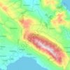
Mount Ainos National Park
Greece > Ioanian Islands > Kefallonia Regional Unit > Municipal Unit of Elios-Proni
Average elevation: 501 m