
Gangapura topographic map
Interactive map
Click on the map to display elevation.
About this map
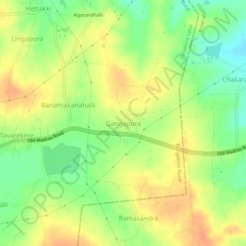
Name: Gangapura topographic map, elevation, terrain.
Location: Gangapura, Hosakote taluk, Bangalore Rural, Karnataka, India (13.11540 77.92688 13.15540 77.96688)
Average elevation: 899 m
Minimum elevation: 877 m
Maximum elevation: 917 m
Other topographic maps
Click on a map to view its topography, its elevation and its terrain.
Haraluru
India > Karnataka > Hosakote taluk
Haraluru, Hosakote taluk, Bangalore Rural, Karnataka, 560164, India
Average elevation: 896 m