
Erin topographic map
Interactive map
Click on the map to display elevation.
About this map
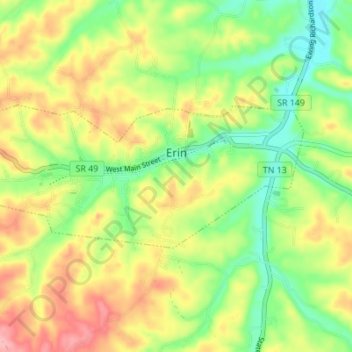
Name: Erin topographic map, elevation, terrain.
Location: Erin, Houston County, Tennessee, United States (36.30357 -87.73770 36.32610 -87.66900)
Average elevation: 168 m
Minimum elevation: 114 m
Maximum elevation: 232 m
Erin is located at 36°19′1″N 87°41′53″W / 36.31694°N 87.69806°W / 36.31694; -87.69806 (36.316998, -87.697946). The elevation is 480 feet above sea level.
Other topographic maps
Click on a map to view its topography, its elevation and its terrain.
Erin
United States > Tennessee > Houston County > Erin
Erin, Houston County, Tennessee, 37061, United States
Average elevation: 173 m