
Kelseyville topographic map
Interactive map
Click on the map to display elevation.
About this map
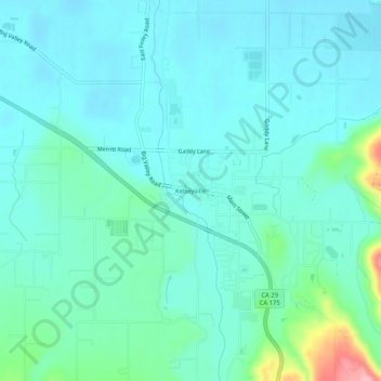
Name: Kelseyville topographic map, elevation, terrain.
Location: Kelseyville, Lake County, California, 95451, United States (38.95795 -122.85944 38.99795 -122.81944)
Average elevation: 431 m
Minimum elevation: 406 m
Maximum elevation: 549 m
Other topographic maps
Click on a map to view its topography, its elevation and its terrain.
Nice
United States > California > Lake County > Nice
Nice is a census-designated place (CDP) in Lake County, California, United States. Nice is located 4.5 miles (7.2 km) southeast of Upper Lake, at an elevation of 1,362 feet (415 m). The population was 2,731 at the 2010 census, up from 2,509 at the 2000 census.
Average elevation: 561 m
Middletown
United States > California > Lake County
Middletown has an elevation of 1,099 feet (335 m). According to the United States Census Bureau, the CDP has a total area of 1.8 square miles (4.7 km2), all of it land.
Average elevation: 371 m
Lower Lake
United States > California > Lake County
Lower Lake is located 4.5 miles (7.2 km) southwest of the City of Clearlake, and 13 miles (21 km) southeast of Kelseyville. It is at an elevation of 1,371 feet (418 m). Lower Lake was at one point the county seat; the Lake County elections of 1867 were hotly contested, with the seat moving between what is now…
Average elevation: 490 m
Clearlake
United States > California > Lake County
Clearlake is a city in Lake County, California. Clearlake is 4.5 miles (7.2 km) north-northwest of Lower Lake, at an elevation of 1,417 feet (432 m). As of the 2020 census, the city had a total population of 16,685, up from 15,250 in 2010. It takes its name from Clear Lake.
Average elevation: 474 m
Clearlake
United States > California > Lake County > Clearlake > Clearlake
Clearlake is a city in Lake County, California. Clearlake is 4.5 miles (7.2 km) north-northwest of Lower Lake, at an elevation of 1,417 feet (432 m). As of the 2020 census, the city had a total population of 16,685, up from 15,250 in 2010. It takes its name from Clear Lake.
Average elevation: 467 m
Lakeport
United States > California > Lake County > Lakeport > Lakeport
Lakeport is an incorporated city and the county seat of Lake County, California. This city is 125 miles (201 km) northwest of Sacramento. Lakeport is on the western shore of the county namesake, Clear Lake, at an elevation of 1,355 feet (413 m). The population was 5,026 at the 2020 census, up from 4,753 at the…
Average elevation: 435 m
Lakeport
United States > California > Lake County
Lakeport is an incorporated city and the county seat of Lake County, California. This city is 125 miles (201 km) northwest of Sacramento. Lakeport is on the western shore of the county namesake, Clear Lake, at an elevation of 1,355 feet (413 m). The population was 5,026 at the 2020 census, up from 4,753 at the…
Average elevation: 427 m