Geolocate

Macomb topographic map

Click on the map to display elevation.

About this map
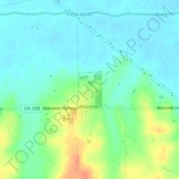
Name: Macomb topographic map, elevation, terrain.

Location: Macomb, Pottawatomie County, Oklahoma, United States (35.14522 -97.01086 35.15075 -97.00650)

Average elevation: 294 m

Minimum elevation: 281 m

Maximum elevation: 324 m

Other topographic maps

Click on a map to view its topography, its elevation and its terrain.

Eason

United States > Oklahoma > Pottawatomie County

Average elevation: 327 m

Gear up for your next adventure:

🧰First Aid Kits - Essential safety kits for outdoor activities
🕶️Glacier Goggles - Maximum protection for high-altitude snow topography
📍Handheld GPS Navigators - Reliable satellite navigation for hiking and off-road exploration
🧢Thermal Beanie Hats - Prevent heat loss from the head in windy summit conditions
📱Phone Mounts for Hiking - Secure mounts to carry your phone on trails

As an Amazon Associate, this site earns from qualifying purchases at no extra cost to you.