
Gaulihütte SAC topographic map
Interactive map
Click on the map to display elevation.
About this map
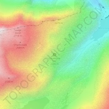
Name: Gaulihütte SAC topographic map, elevation, terrain.
Average elevation: 2,253 m
Minimum elevation: 1,790 m
Maximum elevation: 2,815 m
Other topographic maps
Click on a map to view its topography, its elevation and its terrain.
Wyler
Zwitserland > Bern/Berne > Innertkirchen > Wyler
Wyler, Innertkirchen, Verwaltungskreis Interlaken-Oberhasli, Verwaltungsregion Oberland, Bern/Berne, 3862, Zwitserland
Average elevation: 1,144 m
Titlis
Zwitserland > Bern/Berne > Innertkirchen
Titlis, Innertkirchen, Verwaltungskreis Interlaken-Oberhasli, Verwaltungsregion Oberland, Bern/Berne, 3862, Zwitserland
Average elevation: 2,520 m