
Le Mourier topographic map
Interactive map
Click on the map to display elevation.
About this map
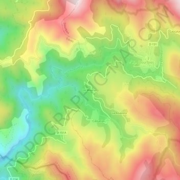
Name: Le Mourier topographic map, elevation, terrain.
Average elevation: 922 m
Minimum elevation: 596 m
Maximum elevation: 1,264 m
Other topographic maps
Click on a map to view its topography, its elevation and its terrain.
Lac des Pises
France > Occitanie > Gard > Dourbies
Lac des Pises, Dourbies, Le Vigan, Gard, Occitanie, France métropolitaine, 30750, France
Average elevation: 1,297 m