
Cheonan-si topographic map
Interactive map
Click on the map to display elevation.
About this map
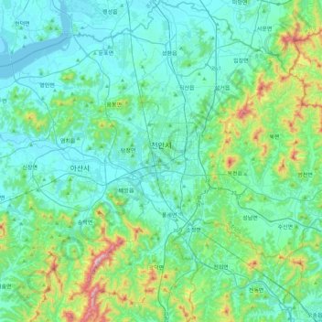
Name: Cheonan-si topographic map, elevation, terrain.
Location: Cheonan-si, Chungnam, South Korea (36.62034 127.00936 36.97316 127.42083)
Average elevation: 112 m
Minimum elevation: -3 m
Maximum elevation: 664 m
Other topographic maps
Click on a map to view its topography, its elevation and its terrain.