
La Millar topographic map
Interactive map
Click on the map to display elevation.
About this map
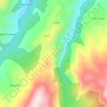
Name: La Millar topographic map, elevation, terrain.
Location: La Millar, Parres, Asturies, Espagne (43.31536 -5.21066 43.33536 -5.19066)
Average elevation: 405 m
Minimum elevation: 151 m
Maximum elevation: 764 m
Other topographic maps
Click on a map to view its topography, its elevation and its terrain.