
Thank you for supporting this site ❤️
Make a donation
Make a donation
Gear up for your next adventure:
As an Amazon Associate, this site earns from qualifying purchases at no extra cost to you.
Loy topographic map
Click on the map to display elevation.
Thank you for supporting this site ❤️
Make a donation
Make a donation
Gear up for your next adventure:
As an Amazon Associate, this site earns from qualifying purchases at no extra cost to you.
About this map
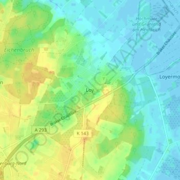
Name: Loy topographic map, elevation, terrain.
Location: Loy, Rastede, Landkreis Ammerland, Lower Saxony, 26180, Germany (53.21032 8.23808 53.25032 8.27808)
Average elevation: 10 m
Minimum elevation: -4 m
Maximum elevation: 25 m
Thank you for supporting this site ❤️
Make a donation
Make a donation
Gear up for your next adventure:
As an Amazon Associate, this site earns from qualifying purchases at no extra cost to you.