
Thank you for supporting this site ❤️
Make a donation
Make a donation
Gear up for your next adventure:
As an Amazon Associate, this site earns from qualifying purchases at no extra cost to you.
Mikinduri topographic map
Click on the map to display elevation.
Thank you for supporting this site ❤️
Make a donation
Make a donation
Gear up for your next adventure:
As an Amazon Associate, this site earns from qualifying purchases at no extra cost to you.
About this map
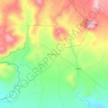
Name: Mikinduri topographic map, elevation, terrain.
Location: Mikinduri, Mikinduri ward, Tigania East, Meru County, Kenya (0.10328 37.81449 0.14328 37.85449)
Average elevation: 1,309 m
Minimum elevation: 1,147 m
Maximum elevation: 1,495 m
Thank you for supporting this site ❤️
Make a donation
Make a donation
Gear up for your next adventure:
As an Amazon Associate, this site earns from qualifying purchases at no extra cost to you.