
Ladozhskaya topographic map
Interactive map
Click on the map to display elevation.
About this map
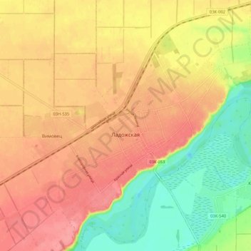
Name: Ladozhskaya topographic map, elevation, terrain.
Average elevation: 78 m
Minimum elevation: 31 m
Maximum elevation: 111 m
Other topographic maps
Click on a map to view its topography, its elevation and its terrain.
БС
Russia > Krasnodar Krai > Ust-Labinsky District > Voronezhskaya
БС, Kubanskaya Street, Voronezhskaya, Воронежское сельское поселение, Ust-Labinsky District, Krasnodar Krai, Southern Federal District, Russia
Average elevation: 56 m