
Montalzat topographic map
Interactive map
Click on the map to display elevation.
About this map
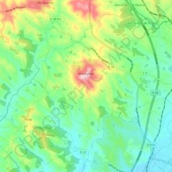
Name: Montalzat topographic map, elevation, terrain.
Average elevation: 169 m
Minimum elevation: 107 m
Maximum elevation: 305 m
Other topographic maps
Click on a map to view its topography, its elevation and its terrain.
Saint-Michel
Frankreich > Okzitanien > Tarn-et-Garonne > Saint-Michel
Saint-Michel, Castelsarrasin, Tarn-et-Garonne, Okzitanien, Metropolitanes Frankreich, 82340, Frankreich
Average elevation: 101 m