
Σίνδος topographic map
Interactive map
Click on the map to display elevation.
About this map
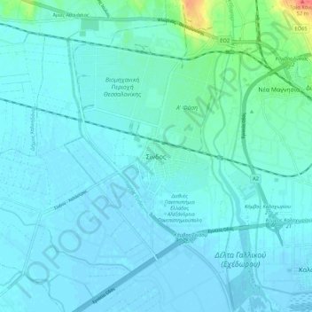
Name: Σίνδος topographic map, elevation, terrain.
Average elevation: 7 m
Minimum elevation: -3 m
Maximum elevation: 54 m
Other topographic maps
Click on a map to view its topography, its elevation and its terrain.
Αγία Σοφία
Greece > Macedonia and Thrace > Thessaloniki Regional Unit > Municipal Unit of Echedoros
Average elevation: 9 m