
Tambarón topographic map
Interactive map
Click on the map to display elevation.
About this map
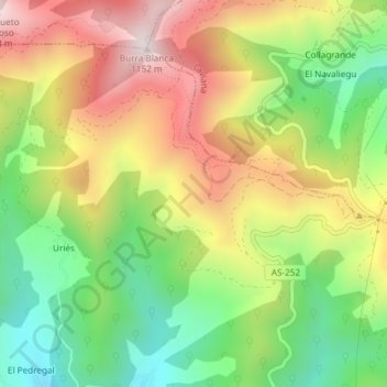
Name: Tambarón topographic map, elevation, terrain.
Location: Tambarón, Aller, Asturias, 33988, España (43.17283 -5.63697 43.19283 -5.61697)
Average elevation: 758 m
Minimum elevation: 431 m
Maximum elevation: 1,134 m
Other topographic maps
Click on a map to view its topography, its elevation and its terrain.
Rio Llananzanes
Rio Llananzanes, Aller, Asturias, 33681, España
Average elevation: 1,096 m
Pico los Aberrugues
Pico los Aberrugues, Aller, Asturias, 33688, España
Average elevation: 1,248 m