
城子村 topographic map
Interactive map
Click on the map to display elevation.
About this map
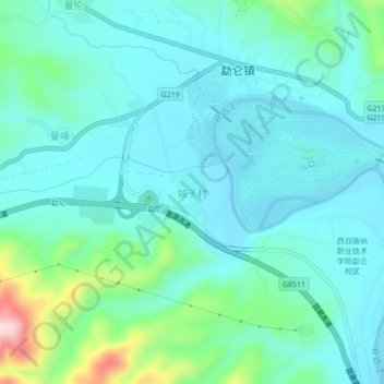
Name: 城子村 topographic map, elevation, terrain.
Location: 城子村, 勐腊县, 西双版纳傣族自治州, 云南省, 666100, 中国 (21.90485 101.22241 21.94485 101.26241)
Average elevation: 582 m
Minimum elevation: 532 m
Maximum elevation: 795 m
Other topographic maps
Click on a map to view its topography, its elevation and its terrain.
中国科学院西双版纳热带植物园-藤本园站
中国科学院西双版纳热带植物园-藤本园站, 勐仑镇, 勐腊县, 西双版纳傣族自治州, 云南省, 666300, 中国
Average elevation: 559 m
西双版纳热带植物园-百竹园
西双版纳热带植物园-百竹园, 勐仑镇, 勐腊县, 西双版纳傣族自治州, 云南省, 666100, 中国
Average elevation: 559 m