
Siniawan topographic map
Interactive map
Click on the map to display elevation.
About this map
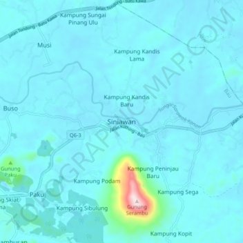
Name: Siniawan topographic map, elevation, terrain.
Location: Siniawan, Bau, Kuching Division, Sarawak, Malaysia (1.40633 110.17957 1.48633 110.25957)
Average elevation: 33 m
Minimum elevation: -2 m
Maximum elevation: 475 m
Other topographic maps
Click on a map to view its topography, its elevation and its terrain.