Geolocate

Ceci topographic map

Click on the map to display elevation.

About this map
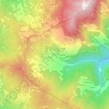
Name: Ceci topographic map, elevation, terrain.

Location: Ceci, Bobbio, Piacenza, Emilia-Romagna, Italy (44.74707 9.28057 44.78707 9.32057)

Average elevation: 1,007 m

Minimum elevation: 517 m

Maximum elevation: 1,451 m

Gear up for your next adventure:

🧥Breathable Waterproof Jackets - Essential rain protection for the unpredictable British climate
📸Action Camera Chest Mounts - Record your ascent following topographic paths hands-free
📻Hand-Crank Emergency Radios - Stay updated on weather warnings in remote areas
👖Hiking Trousers - Durable trousers designed for rough terrain
🐕Hiking Dog Harnesses - Rugged harnesses for taking your companion on mountain trails

As an Amazon Associate, this site earns from qualifying purchases at no extra cost to you.