Geolocate

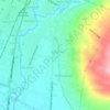
Madyopuro topographic map

Click on the map to display elevation.

About this map

Name: Madyopuro topographic map, elevation, terrain.

Location: Madyopuro, Malang, Blimbing, East Java, 65138, Indonesia (-8.00634 112.66111 -7.96902 112.67880)

Average elevation: 486 m

Minimum elevation: 412 m

Maximum elevation: 592 m

Other topographic maps

Click on a map to view its topography, its elevation and its terrain.

Tarekot Malang City Park

Indonesia > East Java > Malang

Average elevation: 445 m

Kedungkandang

Indonesia > East Java > Malang

Average elevation: 453 m

Gear up for your next adventure:

🧊Insulated Flasks - Keeps drinks hot or cold during hikes
🎒Hiking Daypacks (20L) - Compact backpacks for day trips and technical mountain ascents
👟Heavy Duty Boot Laces - Always carry a spare for your hiking footwear
🚲Bikepacking Frame Bags - Storage for tools and navigation gear on long off-road rides
🔋Lithium AA Batteries - Long-lasting power that performs well in cold mountain weather

As an Amazon Associate, this site earns from qualifying purchases at no extra cost to you.