Geolocate

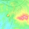
Uzunbey topographic map

Click on the map to display elevation.

About this map

Name: Uzunbey topographic map, elevation, terrain.

Location: Uzunbey, Polatlı, Ankara, Central Anatolia Region, 06900, Turkey (39.06701 31.98003 39.10701 32.02003)

Average elevation: 850 m

Minimum elevation: 809 m

Maximum elevation: 910 m

Other topographic maps

Click on a map to view its topography, its elevation and its terrain.
Şentepe Mahallesi

Turkey > Polatlı

Average elevation: 862 m

Gear up for your next adventure:

👟Heavy Duty Boot Laces - Always carry a spare for your hiking footwear
🛑Emergency Bivvy Bags - Heat-reflective survival bags for unexpected nights out
🧰Survival Kits - Emergency tools for remote environments
🥄Titanium Camping Sporks - The ultimate lightweight utensil for trail meals
🗺️Ordnance Survey Maps - Official UK maps for walking and outdoor activities

As an Amazon Associate, this site earns from qualifying purchases at no extra cost to you.