
Cerro Cristal topographic map
Interactive map
Click on the map to display elevation.
About this map
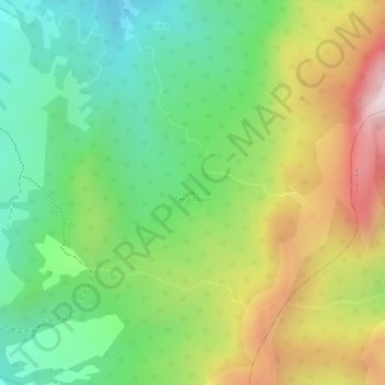
Name: Cerro Cristal topographic map, elevation, terrain.
Location: Cerro Cristal, Chocontá, Almeidas, Cundinamarca, Colombia (5.01948 -73.69242 5.01958 -73.69232)
Average elevation: 3,016 m
Minimum elevation: 2,774 m
Maximum elevation: 3,344 m