
Thank you for supporting this site ❤️
Make a donation
Make a donation
Gear up for your next adventure:
As an Amazon Associate, this site earns from qualifying purchases at no extra cost to you.
Jurado topographic map
Click on the map to display elevation.
Thank you for supporting this site ❤️
Make a donation
Make a donation
Gear up for your next adventure:
As an Amazon Associate, this site earns from qualifying purchases at no extra cost to you.
About this map
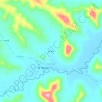
Name: Jurado topographic map, elevation, terrain.
Location: Jurado, Parroquia La Unión, Santa Ana, Manabí, Ecuador (-1.23604 -80.20728 -1.19604 -80.16728)
Average elevation: 120 m
Minimum elevation: 71 m
Maximum elevation: 302 m
Thank you for supporting this site ❤️
Make a donation
Make a donation
Gear up for your next adventure:
As an Amazon Associate, this site earns from qualifying purchases at no extra cost to you.
Other topographic maps
Click on a map to view its topography, its elevation and its terrain.
San Pablo de Pueblo Nuevo
Ecuador > Manabí > Santa Ana > San Pablo de Pueblo Nuevo
Average elevation: 125 m