
Thank you for supporting this site ❤️
Make a donation
Make a donation
Gear up for your next adventure:
As an Amazon Associate, this site earns from qualifying purchases at no extra cost to you.
Barsi topographic map
Click on the map to display elevation.
Thank you for supporting this site ❤️
Make a donation
Make a donation
Gear up for your next adventure:
As an Amazon Associate, this site earns from qualifying purchases at no extra cost to you.
About this map
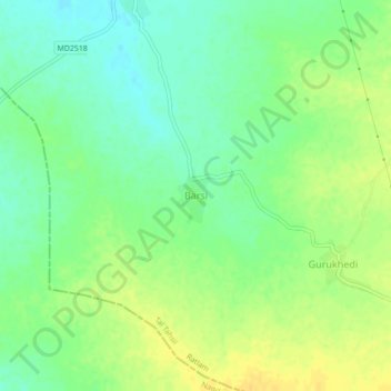
Name: Barsi topographic map, elevation, terrain.
Location: Barsi, Tal Tahsil, Ratlam, Madhya Pradesh, India (23.56653 75.40234 23.60653 75.44234)
Average elevation: 479 m
Minimum elevation: 466 m
Maximum elevation: 491 m
Thank you for supporting this site ❤️
Make a donation
Make a donation
Gear up for your next adventure:
As an Amazon Associate, this site earns from qualifying purchases at no extra cost to you.