Geolocate

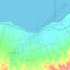
Magepanda topographic map

Click on the map to display elevation.

About this map

Name: Magepanda topographic map, elevation, terrain.

Location: Magepanda, Sikka, East Nusa Tenggara, Indonesia (-8.62316 121.97679 -8.51326 122.14104)

Average elevation: 396 m

Minimum elevation: 0 m

Maximum elevation: 1,408 m

Other topographic maps

Click on a map to view its topography, its elevation and its terrain.

Riit

Indonesia > East Nusa Tenggara > Sikka

Average elevation: 856 m

Maumere

Indonesia > East Nusa Tenggara > Sikka

Average elevation: 53 m

Maumere

Indonesia > East Nusa Tenggara > Sikka

Average elevation: 53 m

Gilting

Indonesia > East Nusa Tenggara > Sikka

Average elevation: 23 m

Gear up for your next adventure:

🧺Microfibre Travel Towels - Fast-drying and compact towels for wild swimming and camping
📻Hand-Crank Emergency Radios - Stay updated on weather warnings in remote areas
☕Insulated Travel Mugs - Keep drinks hot while surveying the landscape from a summit
🧼Camping Hygiene Kits - Compact hygiene essentials for outdoor stays
🔭Compact Hiking Binoculars - Lightweight optics for scouting terrain and spotting wildlife

As an Amazon Associate, this site earns from qualifying purchases at no extra cost to you.