
曲孜卡乡 topographic map
Interactive map
Click on the map to display elevation.
About this map
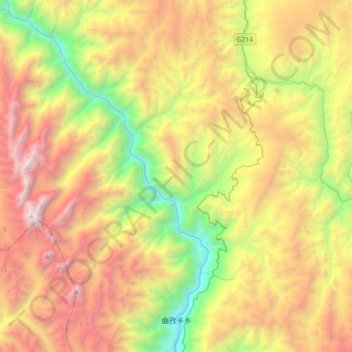
Name: 曲孜卡乡 topographic map, elevation, terrain.
Location: 曲孜卡乡, 芒康县, 昌都市, 西藏自治区, 中国 (29.06258 98.39146 29.37013 98.74487)
Average elevation: 4,042 m
Minimum elevation: 2,297 m
Maximum elevation: 6,242 m
Other topographic maps
Click on a map to view its topography, its elevation and its terrain.