Geolocate

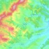
Jac topographic map

Click on the map to display elevation.

About this map

Name: Jac topographic map, elevation, terrain.

Location: Jac, Creaca, Sălaj, 457096, Romania (47.14725 23.17832 47.18725 23.21832)

Average elevation: 282 m

Minimum elevation: 217 m

Maximum elevation: 474 m

Other topographic maps

Click on a map to view its topography, its elevation and its terrain.

Ip

Romania > Sălaj

Average elevation: 236 m

Zalău

Romania > Sălaj

The city includes a total surface of 90.09 km2 (34.78 sq mi). This includes the one village it administers, Stâna (Felsőnyárló), situated south-east of Meseș, in the hydrographic basin of the Agrij River. Măgura Stânii is at an altitude of 716 m (2,349 ft).

Average elevation: 346 m

Crasna

Romania > Sălaj

Average elevation: 301 m

Jibou

Romania > Sălaj

Average elevation: 270 m

Mirșid

Romania > Sălaj

Average elevation: 328 m

Nușfalău

Romania > Sălaj

Average elevation: 259 m

Zalău

Romania > Sălaj

The city includes a total surface of 90.09 km2 (34.78 sq mi). This includes the one village it administers, Stâna (Felsőnyárló), situated south-east of Meseș, in the hydrographic basin of the Agrij River. Măgura Stânii is at an altitude of 716 m (2,349 ft).

Average elevation: 317 m
Treznea

Romania > Sălaj

The commune is situated in the foothills of the Meseș Mountains, at an altitude of 304 m (997 ft), on the banks of the river Treznea. It is located in the central-south part of Sălaj County, at a distance of 14 km (8.7 mi) from the county seat, Zalău.

Average elevation: 385 m

Camăr

Romania > Sălaj

Average elevation: 251 m

Marca

Romania > Sălaj

Average elevation: 244 m

Meseșenii de Jos

Romania > Sălaj

Average elevation: 335 m

Hereclean

Romania > Sălaj

Average elevation: 267 m

Bic

Romania > Sălaj

Average elevation: 318 m

Halmășd

Romania > Sălaj

Average elevation: 382 m

Almașu

Romania > Sălaj

Average elevation: 433 m

Gear up for your next adventure:

👖Convertible Hiking Trousers - Versatile zip-off pants for changing mountain weather conditions
🎒Backpack Rain Covers - Universal waterproof covers to protect your gear from downpours
🧴Tick Removal Tools - Small, essential health tool for UK woodland and moorland
🧊Personal Water Filters - Drink safely from mountain streams marked on your map
🔋Power Banks - Portable chargers for long outdoor trips

As an Amazon Associate, this site earns from qualifying purchases at no extra cost to you.