
Imanaka topographic map
Interactive map
Click on the map to display elevation.
About this map
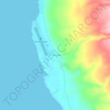
Name: Imanaka topographic map, elevation, terrain.
Location: Imanaka, Tafea, Vanuatu (-19.47991 169.20918 -19.43991 169.24918)
Average elevation: 47 m
Minimum elevation: -1 m
Maximum elevation: 185 m
Other topographic maps
Click on a map to view its topography, its elevation and its terrain.