Geolocate

Cambarco topographic map

Click on the map to display elevation.

About this map
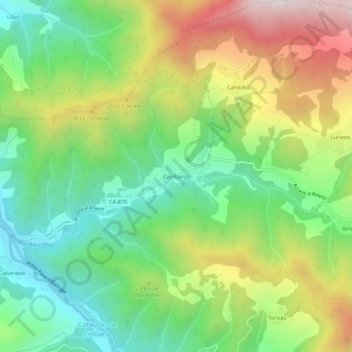
Name: Cambarco topographic map, elevation, terrain.

Location: Cambarco, Cabezón de Liébana, Cantabria, 39571, Spain (43.13016 -4.58330 43.17016 -4.54330)

Average elevation: 686 m

Minimum elevation: 323 m

Maximum elevation: 1,249 m

Gear up for your next adventure:

👟Men's Trail Running Shoes - Lightweight grip for fast movement over topographic contours
🔋Lithium AA Batteries - Long-lasting power that performs well in cold mountain weather
🧤Waterproof Overmitts - Extreme weather protection for hikers and mountaineers
🧼Biodegradable Soap - Leave-no-trace hygiene for multi-day mountain treks
🗺️Ordnance Survey Maps - Essential paper maps for hiking across the UK national parks

As an Amazon Associate, this site earns from qualifying purchases at no extra cost to you.