
Zontecomatlán topographic map
Interactive map
Click on the map to display elevation.
About this map
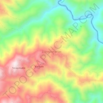
Name: Zontecomatlán topographic map, elevation, terrain.
Location: Zontecomatlán, Olinalá, Guerrero, Mexico (17.85278 -98.66306 17.89278 -98.62306)
Average elevation: 1,158 m
Minimum elevation: 808 m
Maximum elevation: 1,546 m