
Juchitlan topographic map
Interactive map
Click on the map to display elevation.
About this map
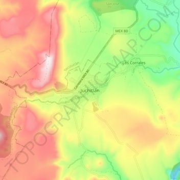
Name: Juchitlan topographic map, elevation, terrain.
Location: Juchitlan, Juchitlán, Jalisco, 48600, Mexique (20.04406 -104.13641 20.12406 -104.05641)
Average elevation: 1,323 m
Minimum elevation: 987 m
Maximum elevation: 1,649 m