
Villavieja topographic map
Interactive map
Click on the map to display elevation.
About this map
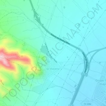
Name: Villavieja topographic map, elevation, terrain.
Average elevation: 66 m
Minimum elevation: 9 m
Maximum elevation: 349 m
Other topographic maps
Click on a map to view its topography, its elevation and its terrain.
Bajo Maestrazgo
España > Comunidad Valenciana > Castellón
Bajo Maestrazgo, Castellón, Comunidad Valenciana, España
Average elevation: 343 m
Masía de la Pereta
España > Comunidad Valenciana > Castellón > Villahermosa del Río
Masía de la Pereta, Villahermosa del Río, El Alto Mijares, Castellón, Comunidad Valenciana, España
Average elevation: 987 m
San Rafael del Río
España > Comunidad Valenciana > Castellón > San Rafael del Río
San Rafael del Río, Bajo Maestrazgo, Castellón, Comunidad Valenciana, 12510, España
Average elevation: 224 m