
Iza topographic map
Interactive map
Click on the map to display elevation.
About this map
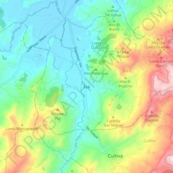
Name: Iza topographic map, elevation, terrain.
Location: Iza, Sagamuxi, Boyacá, 152240, Colombia (5.57230 -73.01948 5.65230 -72.93948)
Average elevation: 2,725 m
Minimum elevation: 2,494 m
Maximum elevation: 3,194 m
Other topographic maps
Click on a map to view its topography, its elevation and its terrain.