
San Borja topographic map
Interactive map
Click on the map to display elevation.
About this map
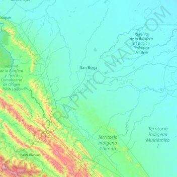
Name: San Borja topographic map, elevation, terrain.
Location: San Borja, General José Ballivián Segurola, Beni, Bolivia (-15.77161 -67.16001 -14.30125 -66.51183)
Average elevation: 338 m
Minimum elevation: 150 m
Maximum elevation: 2,225 m
Other topographic maps
Click on a map to view its topography, its elevation and its terrain.