
Forteresse du Mont-Valérien topographic map
Interactive map
Click on the map to display elevation.
About this map
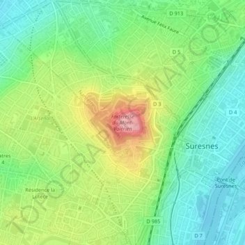
Name: Forteresse du Mont-Valérien topographic map, elevation, terrain.
Average elevation: 78 m
Minimum elevation: 27 m
Maximum elevation: 166 m
Other topographic maps
Click on a map to view its topography, its elevation and its terrain.
Quartier Mont-Valérien
France > Île-de-France > Hauts-de-Seine > Suresnes
Quartier Mont-Valérien, Suresnes, Nanterre, Hauts-de-Seine, Île-de-France, France métropolitaine, 92150, France
Average elevation: 76 m