Geolocate

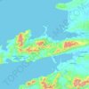
Beaufort topographic map

Click on the map to display elevation.

About this map

Name: Beaufort topographic map, elevation, terrain.

Location: Beaufort, Kenmare Municipal District, County Kerry, Munster, V93 E029, Ireland (52.04897 -9.65665 52.08897 -9.61665)

Average elevation: 41 m

Minimum elevation: 10 m

Maximum elevation: 102 m

Other topographic maps

Click on a map to view its topography, its elevation and its terrain.
Dingle Peninsula

Ireland > County Kerry

Average elevation: 75 m

Tralee

Ireland > County Kerry

Average elevation: 20 m

Castleisland

Ireland > County Kerry

Average elevation: 33 m

Fossa

Ireland > County Kerry

Average elevation: 42 m

Kilgarvan

Ireland > County Kerry

Average elevation: 71 m

Dingle

Ireland > County Kerry

Dingle's St. Mary's is a neo-Gothic church built to designs by J. J. McCarthy and O'Connell. The foundation stone was laid in 1862. It originally had a nave and aisles separated by arcades, supported on columns capped by octagonal tops. The arcades were demolished in one of the most radical reordering schemes…

Average elevation: 41 m

Portmagee

Ireland > County Kerry

Average elevation: 27 m

Rathmore

Ireland > County Kerry

Average elevation: 149 m

Spunkane

Ireland > County Kerry

Average elevation: 22 m

Grenagh

Ireland > County Kerry

Average elevation: 36 m

Dooaghs

Ireland > County Kerry

Average elevation: 10 m

Beaufort

Ireland > County Kerry

Average elevation: 38 m

Tarbert

Ireland > County Kerry

Average elevation: 22 m

Gear up for your next adventure:

⛺Lightweight Solo Tents - Backpacking tents designed for wild camping in the UK highlands
🧥Waterproof Hiking Jackets - Rain protection for walking in all weather conditions
🥾Hiking Boots - Waterproof and durable boots for long-distance hiking in the UK
📦Dry Bags - Waterproof bags to protect gear from rain
🎒Hiking Daypacks (20L) - Compact backpacks for day trips and technical mountain ascents

As an Amazon Associate, this site earns from qualifying purchases at no extra cost to you.