
Udayamperoor topographic map
Interactive map
Click on the map to display elevation.
About this map
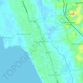
Name: Udayamperoor topographic map, elevation, terrain.
Average elevation: 7 m
Minimum elevation: -1 m
Maximum elevation: 32 m
Other topographic maps
Click on a map to view its topography, its elevation and its terrain.
Kakkanad
India > Kerala > Kanayannur > Kakkanad
Kakkanad, Kanayannur, Ernakulam district, Kerala, 682030, India
Average elevation: 13 m
Ernakulam
India > Kerala > Kanayannur
Ernakulam, Kanayannur, Ernakulam District, Kerala, 682035, India
Average elevation: 6 m