Geolocate

信丰县 topographic map

Interactive map

Click on the map to display elevation.

About this map

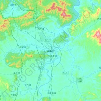
Name: 信丰县 topographic map, elevation, terrain.

Location: 信丰县, 赣州市, 江西省, 中国 (25.22887 114.75833 25.54887 115.07833)

Average elevation: 216 m

Minimum elevation: 131 m

Maximum elevation: 743 m

Other topographic maps

Click on a map to view its topography, its elevation and its terrain.

西牛镇

中国 > 江西省 > 信丰县

西牛镇, 信丰县, 赣州市, 江西省, 中国

Average elevation: 197 m

马塘

中国 > 江西省 > 信丰县 > 老屋杨村

马塘, 老屋杨村, 信丰县, 赣州市, 江西省, 中国

Average elevation: 189 m

下塆仔

中国 > 江西省 > 信丰县 > 前山村

下塆仔, 前山村, 信丰县, 赣州市, 江西省, 中国

Average elevation: 171 m