Geolocate

Rochemolles topographic map

Click on the map to display elevation.

About this map
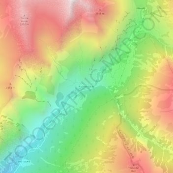
Name: Rochemolles topographic map, elevation, terrain.

Location: Rochemolles, Bardonecchia, Torino, Piemonte, 10052, Italia (45.09259 6.72658 45.13259 6.76658)

Average elevation: 2,125 m

Minimum elevation: 1,349 m

Maximum elevation: 2,965 m

Gear up for your next adventure:

🥤Hiking Water Bottles - Reusable bottles for hydration on the trail
📦Compression Sacks - Reduce backpack volume efficiently
🧰Survival Kits - Emergency tools for remote environments
⛺Camping Shelters - Emergency and lightweight shelters for outdoor use
🧢Waterproof Hiking Hats - Keep the rain off your face while studying topographic maps

As an Amazon Associate, this site earns from qualifying purchases at no extra cost to you.