Geolocate

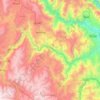
Yanacocha topographic map

Click on the map to display elevation.

About this map

Name: Yanacocha topographic map, elevation, terrain.

Location: Yanacocha, Pomacocha, Province of Acobamba, Huancavelica, 09380, Peru (-12.86455 -74.54685 -12.82455 -74.50685)

Average elevation: 3,468 m

Minimum elevation: 2,925 m

Maximum elevation: 3,831 m

Other topographic maps

Click on a map to view its topography, its elevation and its terrain.

Santiago de Tucuma

Peru > Huancavelica

Average elevation: 3,435 m

Acoria

Peru > Huancavelica

Average elevation: 3,885 m

Mollepampa

Peru > Huancavelica

Average elevation: 3,816 m

Río Urubamba

Peru > Huancavelica

Average elevation: 3,470 m

Gear up for your next adventure:

🧢Thermal Beanie Hats - Prevent heat loss from the head in windy summit conditions
🧵Survival Paracord - Multi-purpose cordage for emergency repairs and shelters
🍱Food Containers - Reusable containers for outdoor meals
📻Hand-Crank Emergency Radios - Stay updated on weather warnings in remote areas
🧭Emergency Beacons - Safety beacons for remote outdoor locations

As an Amazon Associate, this site earns from qualifying purchases at no extra cost to you.