
Llanfair topographic map
Click on the map to display elevation.
About this map
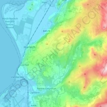
Name: Llanfair topographic map, elevation, terrain.
Location: Llanfair, Harlech, Gwynedd, Wales, United Kingdom (52.82598 -4.13124 52.88064 -3.98183)
Average elevation: 153 m
Minimum elevation: -1 m
Maximum elevation: 664 m
Gwynedd trails, hiking, mountain biking, running and outdoor activities
Other topographic maps
Click on a map to view its topography, its elevation and its terrain.
Morfa Harlech National Nature Reserve
United Kingdom > Wales > Gwynedd > Harlech
Average elevation: 3 m