Monda topographic map
Click on the map to display elevation.
Monda
Monda is a town and municipality in the province of Málaga, part of the autonomous community of Andalusia in southern Spain. It is located near Sierra Blanca and Sierra de las Nieves in the comarca of Sierra de las Nieves. The municipality is situated approximately 44 kilometres from the provincial capital of Málaga and 10 from Coín. Monda has an altitude of 427 metres. It has a population of approximately 2,000 residents. The natives are called Mondeños.
About this map
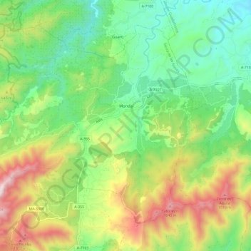
Name: Monda topographic map, elevation, terrain.
Location: Monda, Sierra de las Nieves, Malaga, Andalusia, 29110, Spain (36.58444 -4.91695 36.66062 -4.79896)
Average elevation: 506 m
Minimum elevation: 126 m
Maximum elevation: 1,187 m
Other topographic maps
Click on a map to view its topography, its elevation and its terrain.