Geolocate

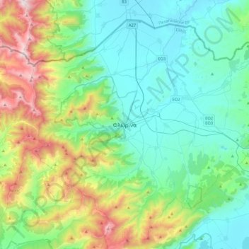
Florina topographic map

Click on the map to display elevation.

Florina

Florina is one of the coldest towns in Greece, because of its elevation and geographic position. Snowfalls, sometimes heavy, thick fog and below-freezing temperatures are common during the winter months, while the summers are warm to hot. Under the Köppen climate classification, Florina has a humid subtropical climate (Cfa), bordering on a humid continental climate (Dfa).

Wikipedia (CC-BY-SA 3.0)

About this map

Name: Florina topographic map, elevation, terrain.

Location: Florina, Florina Municipal Unit, Municipality of Florina, Florina Regional Unit, Western Macedonia, Epirus and Western Macedonia, 531 00, Greece (40.73944 21.36747 40.81944 21.44747)

Average elevation: 814 m

Minimum elevation: 611 m

Maximum elevation: 1,549 m

Gear up for your next adventure:

🔥Reusable Hand Warmers - Maintain dexterity in your fingers for precise map handling
🌂Windproof Trekking Umbrellas - Surprising but effective rain protection on low-wind trails
🧰First Aid Kits - Essential safety kits for outdoor activities
🥾Trekking Poles - Poles to improve stability on uneven terrain
🦯Walking Poles - Supportive poles for long-distance walking

As an Amazon Associate, this site earns from qualifying purchases at no extra cost to you.