
Senchi topographic map
Interactive map
Click on the map to display elevation.
About this map
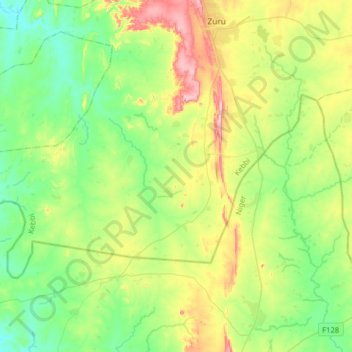
Name: Senchi topographic map, elevation, terrain.
Location: Senchi, Zuru, Kebbi State, Nigeria (11.20463 4.99638 11.38590 5.31598)
Average elevation: 338 m
Minimum elevation: 259 m
Maximum elevation: 506 m
Other topographic maps
Click on a map to view its topography, its elevation and its terrain.
Kukun
Nigeria > Kebbi State > Zuru > Manga Ushe > Kukun
Kukun, Manga Ushe, Zuru, Kebbi State, Nigeria
Average elevation: 367 m