Geolocate

Rongo topographic map

Click on the map to display elevation.

About this map

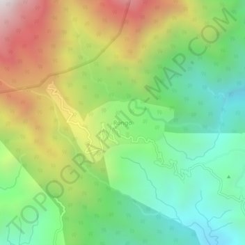
Name: Rongo topographic map, elevation, terrain.

Location: Rongo, Gorubathan, Kalimpong district, West Bengal, India (27.01856 88.81588 27.05856 88.85588)

Average elevation: 1,030 m

Minimum elevation: 480 m

Maximum elevation: 1,892 m

Gear up for your next adventure:

🌂Windproof Trekking Umbrellas - Surprising but effective rain protection on low-wind trails
🎒Hiking Backpacks - Comfortable backpacks for day hikes and multi-day treks
🧤Waterproof Overmitts - Extreme weather protection for hikers and mountaineers
🥄Titanium Camping Sporks - The ultimate lightweight utensil for trail meals
🥾Women's Waterproof Hiking Boots - High-performance trekking boots designed for all-weather comfort

As an Amazon Associate, this site earns from qualifying purchases at no extra cost to you.