
Geumjeong-gu topographic map
Interactive map
Click on the map to display elevation.
About this map
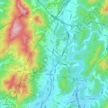
Name: Geumjeong-gu topographic map, elevation, terrain.
Location: Geumjeong-gu, Busan, South Korea (35.20960 129.03666 35.30670 129.14542)
Average elevation: 208 m
Minimum elevation: 3 m
Maximum elevation: 767 m