
Mont-Laurier topographic map
Interactive map
Click on the map to display elevation.
About this map
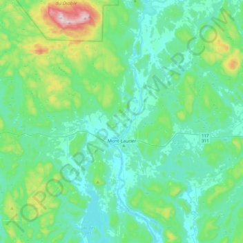
Name: Mont-Laurier topographic map, elevation, terrain.
Location: Mont-Laurier, Antoine-Labelle, Laurentides, Québec, Canada (46.43809 -75.75153 46.70897 -75.39992)
Average elevation: 296 m
Minimum elevation: 197 m
Maximum elevation: 761 m
Other topographic maps
Click on a map to view its topography, its elevation and its terrain.
Montagne de l'Aveugle
Canada > Québec > Antoine-Labelle > Notre-Dame-du-Laus
Montagne de l'Aveugle, Notre-Dame-du-Laus, Antoine-Labelle, Laurentides, Québec, Canada
Average elevation: 390 m
Lac Mercier
Canada > Québec > Antoine-Labelle > Nominingue
Lac Mercier, Nominingue, Antoine-Labelle, Laurentides, Québec, Canada
Average elevation: 292 m