
Refuge de l'Onda topographic map
Interactive map
Click on the map to display elevation.
About this map
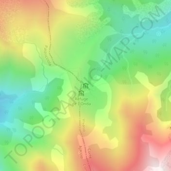
Name: Refuge de l'Onda topographic map, elevation, terrain.
Average elevation: 1,506 m
Minimum elevation: 1,016 m
Maximum elevation: 2,155 m
Other topographic maps
Click on a map to view its topography, its elevation and its terrain.
Vizzavona Gare
Frankrijk > Corsica > Haute-Corse > Vivario > Vizzavona Gare
Vizzavona Gare, Vivario, Corte, Haute-Corse, Corsica, Metropolitaans Frankrijk, 20219, Frankrijk
Average elevation: 1,228 m