
Thank you for supporting this site ❤️
Make a donation
Make a donation
Gear up for your next adventure:
As an Amazon Associate, this site earns from qualifying purchases at no extra cost to you.
Villatella topographic map
Click on the map to display elevation.
Thank you for supporting this site ❤️
Make a donation
Make a donation
Gear up for your next adventure:
As an Amazon Associate, this site earns from qualifying purchases at no extra cost to you.
About this map
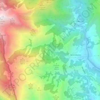
Name: Villatella topographic map, elevation, terrain.
Location: Villatella, Ventimiglia, Imperia, Liguria, 19039, Italia (43.80873 7.51599 43.84873 7.55599)
Average elevation: 541 m
Minimum elevation: 39 m
Maximum elevation: 1,365 m
Thank you for supporting this site ❤️
Make a donation
Make a donation
Gear up for your next adventure:
As an Amazon Associate, this site earns from qualifying purchases at no extra cost to you.