
Thank you for supporting this site ❤️
Make a donation
Make a donation
Gear up for your next adventure:
As an Amazon Associate, this site earns from qualifying purchases at no extra cost to you.
Usseira topographic map
Click on the map to display elevation.
Thank you for supporting this site ❤️
Make a donation
Make a donation
Gear up for your next adventure:
As an Amazon Associate, this site earns from qualifying purchases at no extra cost to you.
About this map
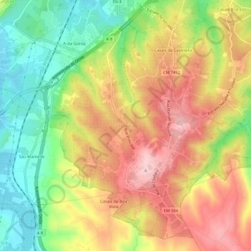
Name: Usseira topographic map, elevation, terrain.
Location: Usseira, Óbidos, Leiria, West, Centro, 2510-772, Portugal (39.31227 -9.17794 39.35227 -9.13794)
Average elevation: 115 m
Minimum elevation: 8 m
Maximum elevation: 219 m
Thank you for supporting this site ❤️
Make a donation
Make a donation
Gear up for your next adventure:
As an Amazon Associate, this site earns from qualifying purchases at no extra cost to you.